We’re all used to using Google and Bing Maps to see amazing aerial photos of places all over the world. But now, ‘The Public Laboratory for Open Technology and Science (PLOTS)’ have created an open source way of taking aerial photos (or even video!) that doesn’t break the bank!
The Public Laboratory for Open Technology and Science (PLOTS) is a community which develops and applies open-source tools to environmental exploration and investigation. By democratizing inexpensive and accessible “Do-It-Yourself” techniques, Public Laboratory creates a collaborative network of practitioners who actively re-imagine the human relationship with the environment.
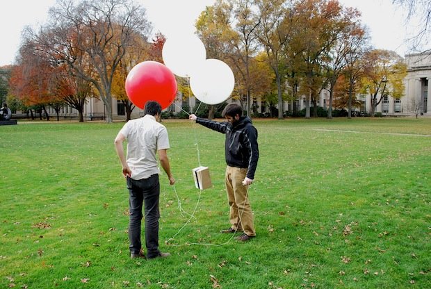
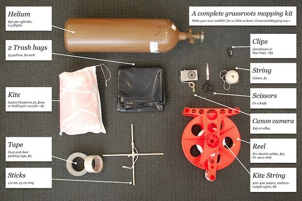
Balloon Mapping uses a small weather balloon, a cheap digital camera (as long as it can do continuous shooting it can be used) and some other bits and bobs to create a setup for taking your own local aerial photos/maps. They say all the equipment costs less than $200. Full instructions for how to make a balloon mapping kit and a balloon mapping wiki are on the PLOTS site.
The technique has been used to track the spread of oil from the Gulf Coast spill. You can hear more about the project on the BBC World Service radio show ‘Click’ and see more mapping projects and photos at the Grassroots Mapping site.
This seems like a really fun project.
How about using it as a way to engage your local community with the Church (to see who your neighbors are!); and if you’re creating a site for a local business what about doing your own ‘how to find us’ using a balloon mapping?!
How else do you think you could use it?
[via The Public Laboratory for Open Technology and Science (PLOTS) | Images via Jeffery Warren]
James Cooper
I'm a God loving, web designing (since the days of Netscape and IE5), bass, ukulele and mandolin playing, geek! Follow James on Twitter | Circle James on Google+


Speak your mind...